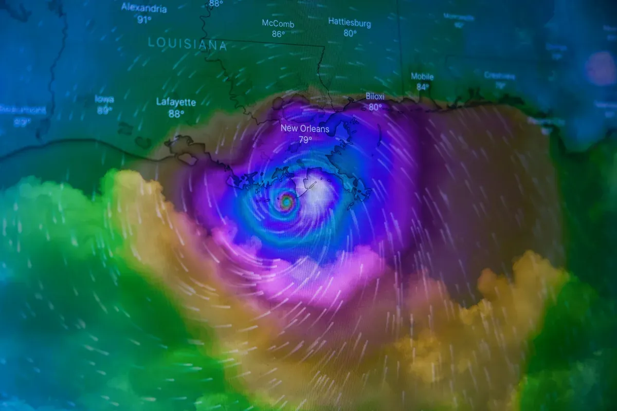
Atlantic hurricane predictions 2026: season dates, how storms form, and how forecasts work

The Atlantic hurricane season is the stretch of the year when tropical storms and hurricanes form over the Atlantic Ocean, the Caribbean Sea, and the Gulf of Mexico. A tropical cyclone is named once its sustained winds reach 39 miles per hour, becomes a hurricane at 74, and counts as a major hurricane at 111 (Category 3 or higher on the Saffir-Simpson scale). Landfall is defined as the moment a storm's center crosses a coastline.
When is hurricane season?
The Atlantic hurricane season runs from June 1 to November 30. The dates are fixed by the National Oceanic and Atmospheric Administration (NOAA) rather than set per storm. By comparison, the Eastern Pacific hurricane season opens two weeks earlier on May 15 and closes on November 30 as well.
Peak activity occurs within a much narrower window. Nearly all major hurricane activity falls between mid-August and mid-October, with September 10 marking the historical statistical peak for active Atlantic tropical systems (according to NHC climatology).
While Kalshi tracks overall storm totals, Polymarket lists separate contracts on specific events, allowing traders to trade on whether a Category 4 or Category 5 hurricane will make landfall in the U.S. during the season.
How do hurricanes form?
Hurricanes form when clusters of thunderstorms over warm tropical ocean waters organize into a closed, spinning low-pressure system. NOAA requires ocean water temperatures of at least 80°F (26.5°C) through the top 50 meters (of ocean). Most Atlantic storms originate as tropical waves, disturbances of low pressure moving west off the African coast.
Evaporation is what powers and “drives” the storm. As warm surface water evaporates, rising moist air cools and condenses, releasing latent heat. This process warms the air column, drops surface pressure, and draws in surrounding air. The Earth’s rotation (via the Coriolis effect) imparts the counterclockwise spin characteristic of Northern hemisphere cyclones.
Two primary forces disrupt hurricane development: strong vertical wind shear, which tilts and disassembles the storm’s vertical core, and dry air or cool ocean water, which starves the storm of heat and moisture.
How do forecasters predict hurricanes?
Forecasters analyze hurricane activity on two operational timelines: seasonal outlooks and real-time storm tracking. NOAA issues its initial seasonal Atlantic outlook in late May with an update in early August. Colorado State University (CSU) issues its primary forecast in April and updates it throughout the summer. Both institutions publish predicted ranges rather than static figures.
Seasonal models evaluate large-scale climate signals rather than individual storms. CSU relies on statistical models factoring in pre-season Atlantic sea surface temperatures and upper-level wind patterns compared against historical seasons. NOAA blends statistical, dynamical, and analog models, heavily weighing the state of the El Niño-Southern Oscillation (ENSO), which regulates Atlantic wind shear.
Prediction markets evaluate these outcomes on a continual basis. Kalshi ladder markets price whether counts exceed specific thresholds, enabling traders to infer a market-derived forecast range. Polymarket landfall contracts price an outcome standard seasonal forecasts do not address: whether a storm makes landfall on the U.S. coast at Category 4 or Category 5 strength.
Major Atlantic hurricanes.
- Aug 2005: Katrina made landfall in southeast Louisiana as a Category 3 hurricane and remains the costliest U.S. tropical cyclone on record.
- Oct 2012: Sandy made landfall near Brigantine, New Jersey as a post-tropical cyclone, generating tropical-storm-force winds spanning an extraordinary 485-mile radius.
- Aug 2017: Harvey struck Rockport, Texas as a Category 4 hurricane before stalling and dropping over 50 inches of rain inland.
- Sep 2017: Irma made landfall at Cudjoe Key, Florida as a Category 4 hurricane before striking the Florida mainland as a Category 3 storm.
- Sep 2017: Maria hit Yabucoa, Puerto Rico as a Category 4 hurricane with 155 mph winds, the island's strongest landfall since 1928.
- Oct 2018: Michael struck Mexico Beach, Florida with 160 mph winds; post-storm analysis upgraded it to a Category 5 U.S. landfall (the first since 1992).
- Sep 2022: Ian made landfall near Cayo Costa, Florida as a Category 4 hurricane with 150 mph sustained winds.
hurricane prediction markets.
events · marketsFrequently asked questions.
Expert take.
Hurricanes
What a hurricane needs to form, where tropical cyclones form, how storms are classified and what drives their strength.
What makes a hurricane "major"?
The Saffir-Simpson scale ranks hurricanes by wind speed, and a storm of Category 3 or above counts as major.
When is hurricane season?
The North Atlantic season runs from June 1 to November 30, and the eastern Pacific season starts earlier, on May 15.
More in Climate & Weather.
2026 Heat & Temperature Predictions: Hottest Year Markets
Live market prices on 2026 heat and temperature records: the hottest year, daily city highs, heat domes, Arctic sea ice, and atmospheric CO2, set against NASA, NOAA, and NSIDC data.

Pandemic Markets 2026: Bird Flu, Measles & Ebola Predictions
A large Ebola outbreak is a declared emergency that WHO says is not a pandemic. See how a pandemic actually gets declared, the record since 2000, and the live markets pricing bird flu, measles, and Ebola.

Earthquake & Volcano Predictions: Live Market Prices
Live market prices on earthquakes and volcanic eruptions, set against the science: worldwide magnitude 7.0+ counts, megaquake and regional risk, and VEI 4+ eruption markets.
Climate & Weather explainers.

Drought Basics: Types, Severity Scale and History
The types of drought, the D0 to D4 severity scale, and the worst droughts in US history.
Severe Storm Basics: Tornadoes, Hail and Wind
Tornado ratings, how severe thunderstorms form, the seasonal pattern, and the records.

Earthquake Basics: Faults, Magnitude and US Risk
Faults, magnitude, the largest US earthquakes, and California's 30-year odds.